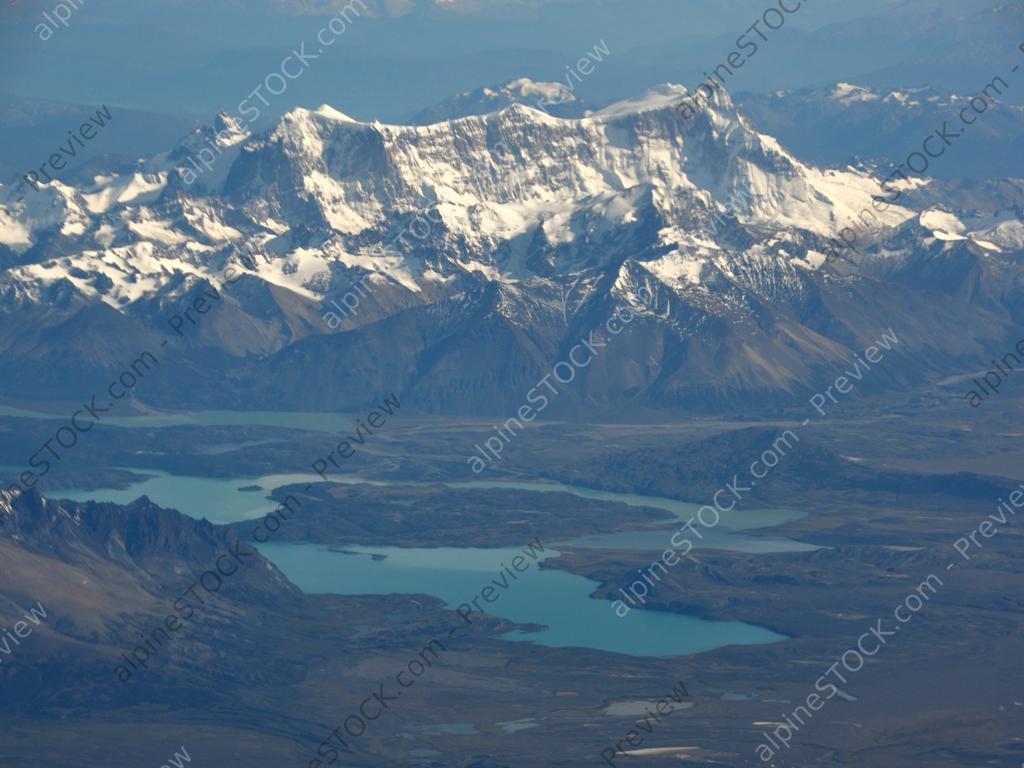
Luftbild des Cerro San Lorenzo, Patagonien
Luftbild des Cerro San Lorenzo, zweithöchster Gipfel Patagoniens auf der Grenze zwischen Argentinien und Chile, mit dem argentinischen Nationalpark Perito Moreno
Christian Peters
20170512.0026772
3797 x 2848
2082
No
No
Purchase a license
schnee, snow, panorama, mountain, weite, flug, berg, national park, eis, gletscher, gipfel, see, bergsee, nationalpark, peak, ice, luftbild, aerial view, lake, high, mountain range, glacier, patagonia, chile, cerro, bergkette, clear, klar, sunny, flight, wolkenlos, hoch, sonnig, luftaufnahme, aerial, schneefeld, weit, selten, wide, argentina, perito moreno, south america, südamerika, argentinien, patagonien, rare, monte, einzigartig, san lorenzo, andes, anden, unique, highest, remote, far, andean, aerial shot, andin, riesig, abgelegen, höchster, huge, seldom, clear sky, aerial photograph, enorm